• About
  • Contact
  • Research & Publications
  • The Blog’s Map
  • Press

Yet Another Urban Blog

~ Yoav Lerman's Blog

Yet Another Urban Blog

Category Archives: Urbanism

Freiburg’s Way

17 Thursday Dec 2015

Posted by Lerman in Academia, Germany, Land-Use, Parking, Planning, Transportation, Urbanism

≈ 1 Comment

Tags

Freiburg, Vauban

Freiburg, a small city in Germany has become one of the role models for sustainable urban development in affluent regions. Freiburg is located in a prosperous region in Germany (the state of Baden-Wurrtemberg) a nation known for its automobile production and use. Even so, during the last 50 years Freiburg has taken a myriad of urban planning and policy steps resulting in a rather low car ownership and low car dependence.

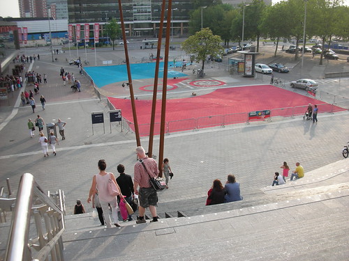
Last year, I was on a tour in Germany where we also visited Freiburg and its celebrated new sustainable quarter called Vauban. This area was an abandoned French military camp, which was reused and turned into a very low car mixed-use residential quarter. The place was re-built using strong platform of cooperation between residents and the city government incorporating all kinds of sustainable solutions including integrated land-use and transportation planning. Freiburg’s light-rail was extended to the Vauban quarter, while parking was heavily restricted. Besides the overall urban plan, Vauban includes many unique sustainable experiments such as the solar settlement consisting of 59 units which produce more energy then they consume, employing solar panels (surprise!).

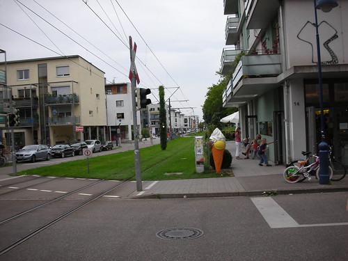
In Vauban’s main street
The Main Street of Vauban

A paper titled “Sustainable Transport in Freiburg: Lessons from Germany’s Environmental Capital” and published at the “International Journal of Sustainable Transportation” sheds light on Freiburg’s path to sustainability, including several anecdotes and recommendations on what can be learned from the Germans’ experience. For example, it describes the way in which Vauban planners managed to avoid the 1:1 mandatory parking minimum ratio for residential developments in Germany:

After long negotiations, Vauban was granted a waiver for minimum parking requirements provided that enough green space was preserved for potential future construction of parking lots. Building permits in Vauban are issued for residential units without parking spots. Residents who decide to own a car can purchase a parking spot in one of the parking garages at the edge of the development for the equivalent of $25,000. Residents who wish to live car-free simply pay a one-time fee of $5,000 to preserve open space at the edge of the development— in lieu of a parking spot.

The authors also describe Freiburg’s streetcar decline and car use rise in the 1950’s and 1960’s which is similar to many other cities in the western world. Besides giving a comprehensive timeline on Freiburg’s sustainable urban planning decisions, the authors point out to an early event, a proposed nuclear plant in the 1970’s that helped form a partnership among many civic groups:

Moreover, during the early 1970s, the planned construction of a nuclear power
plant just 30km from Freiburg’s old town made environmental protection a critical issue (Hopwood 2007). Protests against the state government’s plan to build the nuclear power plant lasted for years and forged an unlikely alliance of leftist students, Catholic and Protestant church leaders, the conservative party, and local farmers. Highly respected civic leaders were at the center of the local opposition to the state government’s plan. Their role in the protests legitimized environmental protection and alternative development ideas for the local population (Chaney 2008;Hopwood 2007).Over the last 40 years Freiburg has developed a strong tradition of cooperation, negotiation, and consensus among city administration, citizen groups, and local businesses (Bratzel 1999). Public discourse, citizen participation, and cooperation paved the way for a gradual change towards sustainability in Freiburg (Bratzel 1999).

In the conclusion of the paper, seven lessons for implementing sustainable transport policies are specified as follows:

  1. Implement controversial policies in stages.
  2. Plans should be flexible and adaptable over time to changing conditions.
  3. Policies must be multi-modal and include both incentives and disincentives.
  4. Fully integrate transport and land-use planning.
  5. Citizen involvement must be an integral part of policy development and implementation.
  6. Support From higher levels of government is crucial to making local policies work.
  7. Sustainable transport policies must be long term, with policies sustained over time, for lasting impact.

It should be noted that Freiburg does not have a transportation planning division, but an integrated urban planning department that combines transportation and land-use planning. This is probably the easiest recommendation to implement (number 4 above) – abolish municipal transportation departments and merge them inside land-use planning. The city keeps growing at a modest pace and is currently planning a new quarter for 10,000 people which will probably rise to new fame when its built.

You can read the full paper on Freiburg’s sustainable urban development here.

  • Facebook
  • Twitter
  • Email

Like this:

Like Loading...

The Neighborhood Unit – A Concept that Should Be Laid to Rest

25 Thursday Jun 2015

Posted by Lerman in Academia, Criticism, Planning, Transportation, Urbanism

≈ 2 Comments

Tags

Clarence Perry, Neighborhood Unit

Criticism of modernistic urban planning and its failures tends to epitomize Le Corbusier as the main culprit behind the change in planning approach during the 20th century. Some may suggest that without Corbusier our urban planning would remain humanistic and rational like at has been during most of human history. While Corbusier definitely deserves an honorary place among the people who destroyed the profession of urban planning and created inhuman habitats, he was far from being alone, and was working in the zeitgeist of his time when many other planners envisaged a slew of anti-urban plans.

One of the modernistic concepts which is (unfortunately) still very much alive is the Neighborhood Unit. This concept was summarized by Clarence Perry in 1929 for New York Regional Survey and is the main subject of this post. Below is the most recognized diagram that is associated with Perry’s work. You may note that Perry surrounded his ideal neighborhood with highways and on further inspection you may also note that he avoided making any direct links from one neighborhood street to another neighborhood across the highway, thus making sure its neighborhood remains in its own limited world.

Neighborhood Unit Diagram. “New York Regional Survey, Vol 7” by Source. Licensed under Fair use via Wikipedia.
Neighborhood Unit Diagram

Perry advocated for planning of an autonomous unit centered around an elementary school with just a little bit of everyday needs in it. When reading his seminal text a few points pop up, that are unfortunately still very prevalent in current planning practices almost a hundred years later. For one, Perry’s meticulous analysis the elementary school (from page 46) carefully examines the number of children in an average household and goes on to use this demographic information as if it was written in stone. Well, as it happens average households in New York today are quite different than they were a hundred years ago (they are much smaller with much fewer families having three children or more) and will probably be very different in another hundred years. The same goes for his analysis of shopping needs (from page 76) which again assumes that society is static. Perry goes into enormous details on the specific shops that are needed inside a neighborhood unit (including a millinery, which is a fancy word for a hat making shop) versus those that should only be found downtown.

The basic assumption is that everything is static – demographics (family size) do not change and society needs at large do not change (schools, churches and so forth). Furthermore, as far as urban development goes, Perry assumes that in the future everything of importance will be concentrated in the downtown and no significant urban changes will occur in terms of metropolitan development and land use dispersal. To some degree, assumptions of an unchanging future are the backbone of all modernistic urban planning. After analyzing people’s needs Perry proceeds towards the street network he thought would liberate people. The text embraces full automobility as inevitable and predicts that in the future everyone will have an automobile and every trip outside of the neighborhood unit will be done by one. It assumes only two kinds of streets – local streets and fast highways. There is no place for main streets (major commercial streets) in Perry’s world. Against this unrealistic background Perry tried to address pedestrian needs and made his neighborhoods completely disconnected from each other and from the city that they were added to.

The diagram below shows how Perry viewed the classic American open-ended grid that is at the base of all the decent urbanism that still remains in the US. In his view the grid led to nowhere in particular, while his closed street scheme leads to “place where people want to go”. In practice the grid leads to a myriad of destinations open to change and growth, while a closed and disconnected street network leads to a place that’s quite resistible to change.

Where do you want to go today?
The neighborhood unit - Perry-42

The prevalence of the Neighborhood Unit concept in urban planning and current state of debate on its merits and downsides is neatly articulated in a recently published academic paper in the Journal of Urbanism by Michael Mehaffy, Sergio Porta and Ombretta Romice. The paper is titled: “The “neighborhood unit” on trial: a case study in the impacts of urban morphology”. Mehaffy et al. show that even advocates that work on urban planning reform such as the American New Urbanism tend to view the Neighborhood Unit in a positive way. The paper goes on to show how Perry tried to separate between slow pedestrians and fast moving vehicles so as to accomodate vehicular traffic to the largest degree possible. The authors dig deep and discuss how Neighborhood Unit plans may lead to increased segregation and significantly hamper public transit:

By not centering neighborhoods on arterials, the Perry model and its variants create a fragmented transit service area that cannot be serviced cost-effectively. According to such critics, this failure has a significant impact on the viability of a public transit system, and on the resulting ability to reduce carbon emissions from urban transportation.

In contrast to the dysfunctional Neighborhood Unit a few examples of real city development with emphasis on well connected urban fabric are given: London, Barcelona and my personal favorite – Portland, Oregon.

Perry’s Neighborhood Unit concept did not wreak havoc only in the USA, but spread across the globe. Israel, which was established during the modernistic golden age (1948) embraced the Neighborhood Unit concept with zeal and now has many municipalities made only of Neighborhood units with no real city parts whatsoever. One example for such a place is the port city of Ashdod (established 1956) which consists of a large port and industrial area to its north and 17 Neighborhood Units to the south. The city has about 250,000 people in it, but instead of utilizing this congregation of people it is actually made up of 17 villages of 10,000-20,000 people, each with its own slowly decaying low-level commerce. Below is Ashdod’s map with its disconnected neighborhoods.

Ashdod is now trying to take one of its arterial roads and turn it into a real urban street, connecting its disjointed neighborhoods (you can read more about it here) with an ambitious plan that tackles street network changes, land use changes, commercial development and public transit. Whether such a change is feasible is open to debate.

In conclusion, planners need to be aware of the Neighborhood Unit’s major shortcomings and should resist the urge to plan a closed and segregated ideal and never-changing urban habitats. After all, those places may be much worse than open-ended places that are open to change.

  • Facebook
  • Twitter
  • Email

Like this:

Like Loading...

Cumbernauld – the Worst Place Ever Planned

02 Thursday Apr 2015

Posted by Lerman in Britain, Criticism, Urbanism

≈ 4 Comments

Tags

Cumbernauld, New Towns, Post-War

Glorious urban failures provide us with excellent opportunities to learn and understand mistaken urban planning concepts and their consequences. This post focuses on one of the more dramatic urban failures, which happened to take place in Britain.

After the second world war, the modernistic approach to architecture and urban planning took hold. While many Europeans countries did not build as much as less developed countries after the war, they still managed to build extensively, and especially Britain. Following the New Towns Act of 1946, the British government promoted the development of tens of new towns in the 1950s and 1960s – probably the worst period of town planning in the West and maybe even the entire world throughout history. On top of all the crappy cities built in Britain during this period, Cumbernauld shines the brightest (or gloomiest). Cumbernauld was established during the 1950s as an independent town north east of Glasgow and at the time was considered the greatest achievement of town building ever and a role model for cities across the world.

Before delving into details, we should note the zeitgeist that led to the building of Cumbernauld. It was the height of Brutalist Modernism and the dominant town planners vision consisted of complete separation between pedestrians and vehicles in the name of safety and freedom of movement. This approach created a town with no crosswalks, and plenty of overpasses and underpasses for pedestrians. On top of the brutal architecture and infantile transportation planning there was a complete separation of land uses, meaning the entire city was made of residential buildings only, and only in its center there were commerce and other uses.

The structure of Cumbernauld city center deserves a special scrutiny. This is not a classic city center of commercial streets with mixed-use buildings along them (including residences, offices and public buildings), but a rather a single huge mega-structure that goes by the name Cumbernauld Town Center. This building was supposed to be built in five phases and have an enormous section of 800 meters on its long side (that’s over 13 street blocks in the compact downtown of Portland, Oregon). Instead of a real city center, this mega-structure was supposed to contain all the functions that the planners thought real cities should have in their center- commerce, education, public buildings, offices, a hospital, a central bus station, a large parking lot for thousands of cars and so on in one huge structure. The planners strove to make the the residential areas in Cumbernauld as sterile as possible so that everyone will conduct whatever business they have under the roof of a single structure. The utopia that the planners of Cumbernauld offered won many prizes and critiques and influenced an entire generation of architects and planners for better or worse. Following the criticism of Cumbernauld, a movie came out in 1970 that describes the high quality of life in the new town and its innovative and successful urban planning. The movie makers boasted that Cumbernauld is the city of the future and would serve as a role model for many cities still to be built.

The PR movie in its entirety is here. The essence can be seen from 11:00 at which point the transportation plan which is the root of all evil is described:

Unfortunately, the reality struck in the faces of the planners. The city center mega-structure of Cumbernauld was partially built over the years, and parts of it were demolished (including the hotel that was there once) and transformed to a modern shopping mall. Cumbernauld never became the city of the future and it’s just a poor suburb of Glasgow today. The town itself and especially its city center structure are notoriously known as the worst urban plan ever conceived in the UK and have won prizes for extremely bad architecture, most notably the Carbuncle Award (twice!). Here’s a short video clip from 2005 on the Cumbernauld dystopia (and another article):

The town itself still draws the attention of planning circles and like other bad places offers a great subject for public discussions:

The subject of post-war planning and new towns in Britain and elsewhere deserves further attention, and I hope to return to this subject soon.

  • Facebook
  • Twitter
  • Email

Like this:

Like Loading...

Making Room for a Planet of Transit Metropolises

03 Saturday Jan 2015

Posted by Lerman in Planning, Transportation, Urbanism

≈ Leave a comment

Tags

Robert Cervero, Shlomo Angel

I ran into two short clips by Robert Cervero and Shlomo (Solly) Angel addressing a few key subjects in the current state of world urbanization. Cervero deals mainly with transit and its power to shape cities in an efficient way, while Angel talks about the coming urban expansion of rapidly urbanizing ares, mainly in the Global South. Combining their insights on urbanization processes one can conclude that expanding cities should take the path of coupling transit and land-use planning while reserving the public rights-of-way needed to accomplish this. And now for the details.

Robert Cervero is an expert on transit and especially on Transit-Oriented-Development (TOD). He has also written the still relevant book The Transit Metropolis where he made observations on several metro areas and their transit innovations. In the short talk below, Cervero goes into detail about the way transit can transform cities. He puts emphasis on integration of public transit and land-use – i.e. dense developments should follow the accessibility provided by the transit systems. Among the more prominent examples that Cervero lays out are Copenhagen’s Finger Plan of 1947, Stockholm’s post-war similar expansion and the Hong Kong’s Mass Transit Railway (MTR) which is quite profitable due to its use of extensive real estate developments above its rail stations. Towards the end of his talk, Cervero mentions that with the invention of BRT (Bus-Rapid-Transit), which the city of Curitiba is famously known for, it is possible to reap the benefits of transit and land-use integration at a much cheaper capital expense than previously thought.

Shlomo Angel has led a significant research effort on world urbanization, which he summarized in his recent book, Planet of Cities. He calls for a paradigm of Making Room, i.e. accepting the fact that rapidly urbanizing metropolitan areas are bound for an explosive land growth, at a much higher rate than their population would grow, while urban densities are destined to decline. He distinguishes between western efforts to contain urban sprawl in stabilized metropolitan areas (many of which sprawled along car dependent suburbanism in the 20th century) and the up and coming metros of the Global South. However, Angel does not mean that a laissez-faire approach is appropriate. As an example he provides Bangkok, which grew in a massive way in the last three decades while staying affordable, but did not secure any arterial rights-of-way and trunk infrastructure leading to an infrastructure disaster.

Angel calls for securing arterial roads of 25-30m width, at distances upto 1km from each other (so people can walk to future public transit on them). This provision should be done ahead of urban growth and can be done also in advance of slum creation/invasion. This was done many times in the city of Lima, resulting in slums capable of relatively smooth improvements over time. As an examples for work on urban expansion in the Global South Angel points to Ahmadabad in India and a few projects he is involved with in Ethiopia and Colombia.

To conclude, Angel’s realistic city expansion plans should be combined with Cervero’s integrated transit-land use planning recommendations, so our still urbanizing planet follow the efficient path of transit metropolises.

  • Facebook
  • Twitter
  • Email

Like this:

Like Loading...

Israeli Planning is Homogeneous and Wasteful

30 Thursday Oct 2014

Posted by Lerman in Academia, Criticism, Housing, Israel, Planning, Urbanism

≈ 2 Comments

This post is based on an academic paper by Daniel Orenstein and Steven Hamburg. The paper sheds light on the Israeli planning system which seems to be producing homogeneous and wasteful products. The full name of the paper is: “Population and pavement: population growth and land development in Israel” and it was published in Population and Environement journal.

The reserach examines the connection between the population growth in Israel and the urban development in the years 1961-1995 (based on four population censuses in the years 1961, 1972, 1983 and 1995). The authors looked at the national level, district level (the six districts that make up Israel) and local level (by examining 40 local authorities). The paper focuses on the conversion of open land to built-up land across time. This land conversion process is compared with population growth has and the way regulation impacts on this process. This reserach was carried out against the background of the necessity to avoid obliterating the remaining open land in Israel. The researchers raise three questions:

1. What is the connection between population growth in Israel and the rate of converting open land to built-up land?

2. Does the scale of analysis affect the strength and magitude of this correlation (scale means national, district or local)?

3. What are the regulatory means that infulence the rate of open land conversion and in what ways?

To carry out the research a number of specific areas all across where chosen including urban, suburban and rural settlements which are also ethnically diverse (meaning taking into account also predominately Arab settlements and not only predominately Jewish settlements). Out of 250 local authorities in Israel 40 were examined (for more please see pager 9-10 in the paper itself). After the selection of the research areas the paper elaborates on the methods used, which employed analysis of aerial photos from different years in order to assess the amoung of land that was converted from open to built. To make the story short I’ll focus on the major findings that arise from this paper.

The first important finding in the national level is that the rate of open land conversion to built-up land is higher than the rate in which the population is growing. Furthermore, this conversion rate is even higher if the sparsely populated Galilee and Negev regions are taken out of the equation. Namely, the open land we build on for the additional population is being eroded at a rate that is growing over time. We waste our land faster than we used to. Another somewhat intuitive finding shows that the rate of sprawl (open land conversion for each additional resident) is higher for the rural settlements and for the northern settlements.

In contrast to the national level, when looking at the sprawl rate at the local authority level, we see that the planning gets more and more homogeneous. The rural regions have a lower sprwal rate than in the past, while the urban areas have a rising rate of sprawl approaching the rural rate. The Arab settlements (which had a tendency for higher sprawl rate) have a decreasing rate of sprawl, while the Jewish settlements have a rising rate of sprawl approching the Arab rate. Thus, while at the national and district levels we are eroding open land at a rising rate (also by establishing new settlements), at the local planning level the urban planning becomes more and more homogeneous. In the words of the researchers:

Sprawl (more space consumed per additional unit of population) is increasing over time at both the national and district scale, yet the locality data do not corroborate these results. The locality data suggest a growing homogenization of development across the Israeli landscape.

Particular attention was given to the effects of the Jewish population dispersal doctrine on the rate of open land conversion (this doctrine goes back to 1948 and aims to redistribute of the Jews in Israel while idealizing rural agrarian lifestyle). It was found that this doctrine is responsible for more open land erosion than the rest of the faulty Israel planning regime. And here is the text itself:

The amount of land developed in the peripheral areas was significantly higher than in the core area, once variation due to population growth and other related factors are removed. Likewise, development in Arab localities was less than in Jewish localities (controlling for other factors), although this difference was statistically significant only for the full 1961–1995 study period. These results reflect a consistent Israeli policy to encourage internal migration of Jewish citizens to the peripheral areas, while concurrently restraining the growth of Arab localities (Falah 1991; Khamaisi 1993; Yiftachel and Rumley 1991), despite the preference of most Jews to live in high-density urban communities in the geographic core area of the country (Kellerman 1993). Various national policies have attempted to attract Jews to the peripheral areas (Kellerman 1993; Newman 1984, 1989). Among them was the development of small, exurban communities with larger homes. By attracting people to these communities, policy magnifies the impact of local population growth on open space in Jewish, rural localities where the amount of land developed per capita is an order of magnitude higher than in any other type of development.

The most astonishing find is the failure to stop open land erosion even in districts where there is not much open land left. Namely, even in places where there is not much open land left, the sprawl rate is not declining. Here it is (emphasis mine):

One somewhat surprising result of the population–development relationship is that for districts in which open land is becoming increasingly scarce, an expected slowing of land development relative to population growth with a concomitant increased importance of open space was not evident. We would have expected to see the rate of land development slow as open space became increasingly rare. Rather, we see the rate of loss of open-space increase (and the rate of land development increase) as open land reserves become smaller. This is true even in the case of the Tel Aviv district, where only a small amount of land (*20%) remained open space by 1990.

In conclusion – at the local level our planning is becoming more and more uniform and provides indication about a central technocratic systems that operate with no context, and creates a uniform built environment. At the district level we are unable to save the open land at all. And at the national level, the loss of open land is at a higher rate than the rate of population growth. For the good of this small and precious country, its planning systems need to be completely reorganized and most of the regulation and the ideology standing behind them have to be shredded – the sooner the better.

You can access the full paper here (and if you do not have access and still want to read it you can leave a reply or contact me).

  • Facebook
  • Twitter
  • Email

Like this:

Like Loading...

How to Upgrade the City Center and Stay Alive – the Case of Utrecht

16 Thursday Oct 2014

Posted by Lerman in Holland, Urbanism

≈ 8 Comments

Tags

Station, Train, Utrecht

What is Utrecht? Utrecht is just another Dutch city, a generic Dutch place if you will. Not really important, not really interesting and not really pretty. Lots of bicycles, rain and Dutch food. Holland in its most common form. So what is special about this not so special place? Utrecht currently leads one of the most complex projects I have come across, and it does so rather successfully.

At the foundation of this urban program called CU 2030 (the target year of the program, which has a bilingual website and a Facebook page) stands the central train station, which is also the largest train station in The Netherlands (due to Utrecht’s location). The train station consists of 14 platforms and almost 300,000 passengers pass through it every day. As part of the program, the station is being expanded to 19 platforms and on top of it dozens of construction and transportion projects are taking place all around. Here is what they say (I’ve highlighted the section that deals with the program partners):

Utrecht is building a new Station Area. This was much needed; ever since the Hoog Catharijne shopping mall was built in the 70s there had been overdue maintenance, neglect, a growing number of passengers, a growing city and the desire to get water back in the old canal. With the contruction of a new and renenewed area all these things are tacled at once.

The historic inner city and the Station Area were two seperated parts of Utrecht; these parts will be connected again to form one coherent centre. Liveliness and safety will be improved. There will be space for culture, leisure, the area will be better accessible and last but not least: water will flow once again in the canal that was filled in during the 70’s.

We’re building a future that’s sustainable: low emission buildings, plenty of pleasant space for bikes, public transport and pedestrians, and solar cells on top of the platforms.The building of the Utrecht Station Area is a close co-operation between the City of Utrecht, Corio (owner of Hoog Catharijne mall), Dutch Rail, ProRail and the Jaarbeurs (tradefair).

You can notice that this complex program involves five major partners – the municipality, the mall that is conencted to the train station and goes by the name Hoog Catharijne (we’ll get to it shortly), both of the Dutch rail companies and the fair grounds. There is no single boss that dictates everything for everyone. Like in many other places, The Dutch built many bad malls in the 1970s, and one of them was placed on Utrecht’s central train station. In fact, to exit from the station to the city center, one must go through the mall (also at night when all the shops are closed). The mall itself has an incoherent internal structure, which became pretty unsafe over the years until they had to shut down the upper floor entirely. As part of the train station upgrade the internal strcuture of the mall is modified so as to make a cleaner and more navigable space eventually. Before we delve further, here is a fantastic clip that explains almost everything:

The Dutch work on a grand scale. This is not a transportation plan nor a construction plan. This is solid urban planning that goes beyond just construction and transportation and includes also contact with the various stakeholders (including the residents), financing and execution. An important aspect is the day to day project management itself. The entire area of the train station lies in a complete disarray, yet the station and its shops are open for business, the mall works and accessibility for bikes, pedestrians and public transit is provided all throughout the project (even though it’s a little bit messy for Holland). The program has an information center open to public, which also provides guided group tours. Yep, the guys from Utrecht city hall do not hide beyond blank walls like is common in other countries.

The new bike parking strcuture is used for seating and relaxing in front of the new square outside of the train station. The 2015 Tour de France will start here.

Jaarbuers Stairs and Bike Parking in Utrecht

The clip shown above was uploaded to the web last March. I visited the Utrecht during the month of July and it appeared to be going as planned. The new concert hall (Tivoli Vredenburg) next to station was already open. The luxurious bike parking strcture, including over 4,700 spaces is in operation, and serves as a convenient platform for relaxing. Overall, more than 30,000 bike parking spaces are planned to built around the station area (and it will not be enough). The new city hall is just about ready. You can see the other projects around the station, including daylighting of a canal that was covered during the 1970s (when even the Dutch thought that the city needs as much asphalt as possible).

Not a dull moment. The new concert hall in the background.

Tivoli Vredenburg Halls

This post demands further discussion on the lessons that can be learned from this urban program. In the meantime, you can keep calm and know that there are public organizations that plan, manage and execute big and complex urban projects. And they do it while sticking to schedule, holding a public discussion and in the right place.

For your convenience, here is a map of Utrecht and its central train station (which is located on the western edge of the old city):

  • Facebook
  • Twitter
  • Email

Like this:

Like Loading...

Do Comprehensive Land-Use Plans Have any Real Meaning?

14 Tuesday Oct 2014

Posted by Lerman in Academia, Criticism, Israel, Land-Use, Planning, Urbanism

≈ Leave a comment

The Israeli planning system deserves a few posts on its problems and challenges. Today, we’ll deal with a study that attempts to evaluate the effectiveness of district master plans with regards to the actual implementation. This post is based on an academic paper written by Dr. Nurit Alfasi, Mr. Jonathan Almagor and Prof. Itzhak Benenson, and which can be found here. This paper was published in Land Use Policy Journal under the title: “The actual impact of comprehensive land-use plans: Insights from high resolution observations.” The researchers have made an attempt to estimate how much does actual construction conform to the actual plans by comparing aerial photographs to district master plans. The results of this study shed light on the ineffectiveness of the urban planning in Israel and should signal to the Minstry of Internal Affairs (that is responsible for most of the actual planning) that it is time to change the way in which the system operates.

First, we must clarify what is meant by district master plans. Israel is divided into six different administrative districts. This division was first created during the British Mandate period and was slightly changed after the establishment of the state of Israel, but is no longer relevant. For example, the Tel Aviv District includes the contiguous urban area that was already built in 1948 (Tel Aviv and its inner suburbs from Hertzliya in the north to Bat Yam in the south). The Central District includes what used to be the agricultural hinterland of Tel Aviv and is now part of the suburban sprawl from Natanya to Rishon Letziyon. Even the Southern District includes part of Tel Aviv Metropolitan area, especially the large suburb of Ashdod. So, after understanding this anachronistic districts division we need to deal with the actual district master plan. This is a comprehensive plan that describes the entire land-use specifications (built and planned) for the whole district. Each district has such a plan and this plan is supposed to set the expected development in the district and has to be updated once all of its planned development have been built. In theory, most of the construction should follow the district master plan, and the discussions in the district planning comittee should ensure that all roads, buildings and parks are built according to the approved plan.

The study dealt with the Central District for its area of reserach. This is the district with the most intense real estate activity in Israel and includes all the growing suburbs of Tel Aviv outside of the inner ring. The study focused on the district master plan also knows as DOP 3 (District Ouline Plan no. 3), which was approved back in 1982. In order to compare the actual construction to the plan aerial photographs from the years 1980, 1990, 2000 and 2006 were used – all in all 26 years of development. DOP 3 itself has undergone an update process in 2002 and became DOP 3/21. Twelve different areas inside the Central Districty were sampled, constituting about ten percent of the entire district area.

Several key findings are revealed when examining the plan compared to the actual development. During the years 1980-1990 more that 50% of the areas developed did not conform to the plan land use map. Yep, you got it – 50 perecnt of the development did not conform to the plan. During the years 1990-2000 the plan was getting even further from reality and more than 60 percent of the areas developed did not conform to the district master plan. It can be concluded that only a small part of land development actually occurs in accordance with the plan itself. It should be added that almost all of the non-conforming land developement was approved by the planning committees themselves, meaning that the planners themselves completely ignore the plan that they have approved to much fanfare. We need to remember that the district master plan is a public plan that costs a lot of time and effort. Additionally, this plan is used for countless comittee discussions wasting even more time. In light of the plan irrelavance it would actually be better to work without such a plan that only wastes resources and does not contribute to the actual planning and developement. The reserchers have also checked whether there was so much developement that the plan allotted areas for development were just insufficient. In a thorough examination it appears not to be the case. There remained enough approved land for development that was not devloped, while the actual construction took place on land that was not slated for development. In the words of the authors themselves:

It appears that despite the vast effort and time invested in preparing and authorizing district land-use maps, this is not an efficient planning tool in terms of restricting development in specific locations

Of all the anecdotes that come out from this study, the most ridiculous case is illustrated in the case of a newly established suburb in the 1980s titled Shoham. Shoham was founded entirely on and area defined as a future public park,  meant to be kept open for its unique environmental values (in sharp contrast to the area defined as farmland, which are easy to run over with urban development.) DOP 3 was approved in 1982 and just a few years down the line, the National Planning Council made the decision to build Shoham. But the problems do not relate just to the 1980s and 1990s. In 2002, a new DOP 3 was approved under the name DOP 3/21 which paractically approved almost all the deviations that occured in the preceding years. Over the four years that were checked after the new DOP was approved, non-conforming development has already started to be prevalent and reached 30 percent in a number of the sampled areas.

At the conclusion of the study, the reserachers elaborate on effective planning methods to replace the current system. These methods do not include rigid and meaningless land-use maps, but a defined set of planning principles by which to evaluate local plans before their approval and execution. Such an action can guarantee a faster and more flexible design that also gives better results. I hope that theserecommedations will not remain only on paper.

The complete paper can be found here.

  • Facebook
  • Twitter
  • Email

Like this:

Like Loading...

Christopher Leinberger and the Urban Option

09 Thursday Oct 2014

Posted by Lerman in Book, Criticism, Housing, Israel, Transportation, Urbanism, USA

≈ 3 Comments

Tags

Christopher Leinberger, Leinberger, urban housing

Israel is going through an extreme housing crisis. On top of it, inner city housing prices are skyrocketing in both in Tel Aviv and in Jerusalem. It’s quite obvious that all the most coveted areas where many people are eager to live in are the older sections, built before the advent of modernist urban planning. A lot of people want the advantages of high density, centrality, the variety of land uses that can be found in proximity and the opportunities that this combination gives. Prices show that may of us are willing to pay much more for this kind of urbanism than for the quiteness of the suburbs. The real estate market should have been responding to this demand for urban living and provide the appartments for the rising demand, but this is far from simple.

Christopher Leinberger, an American urbanist and real estate developer, describes a similar phenonmenon in the US in his book “The Option of Urbanism”. For years, the central cities in the US were dwindling and their affluent residents have been moving away to the suburbs, but now the dense urban centers have come back to be the most desirable the most expensive from a real estate perspective. Leinberger claims that the change in lifestyle and urban culture lead more and more people of all ages to prefer dense urban living in city center flats with a variety of transportation choices over spacious living with ample parking and greenery in the suburbs. He also finds parallels in mainstream culture. In 1939 Ford presented the suburban dream for the first time on a large scale, and in the 1970s the major sitcoms like the Brady Bunch have praised the good life in the suburbs, and then in the 1990s Seinfeld (and Sex and the City afterwards) have brought to TV the urban dream of living in a busy city.

OptionofUrbanism

The book subtitle is “Investing in a New American Dream”. Leinbereger is not just another researcher of real estate and urbanism, but also a developer that works toward building walkable urban neighborhoods, which are very hard to create under the current regulations. Leinberger does not divide the urban fabric to city and suburbs according to arbitrary municipal lines, but rather to walkable urban sections and drivale suburban sections. Walkable urban areas usually offer multiple transportation choices besdies walking such as biking, public transit and private vehicles, while in drivable suburban areas that only rational transportion option is private vehicles. Leinberger demonstrates that older suburbs consist of walkable urban areas, while central cities have parts that are drivable only.

The growing demand for walkable urban living over drivable suburban houses is expressed by gentrification processes that change entire neghborhoods from slums to luxury areas where every built square meter is worth its weight in gold. Besides describing the change in consumer preferences, Leinbereger describes how the price of urban built square meter have risen over the years and surpassed the price of built square meter in the suburbs. He goes on to show an interesting reason for the high urban housing and it does not involve a crazy free market running wild, but rather too much regulation in the housing market. This regulation allows for suburban housing only (Leinberger specifies 19 standard real estate products in the American market) and impedes the building of urban housing in walkable areas.

The Israeli equivalent to the American standards are the regulations on parking and public open spaces. At first sight both appear to be logical – all we need is parking for our cars a little bit of grass for grazing. The minimum parking regulations, which enforce developers to provide at least one parking space for each appartment, raises the housing costs and inhibits the creation of high density which is needed for vital urban life. The public open spaces standards also serve to reduce the density. The combination of these regulations makes sure that all newly built neighborhoods will be drivable only and a car will be used for each and every daily errand. This might fit a few people wishes but not everyone. It appears that also in Israel there is a growing population that desire to live in an intensive and dense urban environment. In such an environment more destinations can be reached by cheaper transportation means such as walking and biking. Kids can walk to school and do not need to be chauffeured by their parents – and there is always a coffeeshop nearby. Such environments can provide plenty of opportunities, and there are more than a few people that are willing to pay good money for this.

The jist of Leinberger’s argument is that after over 60 years of building only parking and grass based housing, the dense urban housing became rare and precious and is coveted by young and old alike. At the end of the day, to enable the market to supply new urban housing (and not neccessarily cheap housing in the suburbs) we need to enable the creation of dense neighborhoods wasting little space on pakring and underused large grassy places. Not all new neighborhoods need to be dense and urban, but we should not outlaw the option to live in high density for those who want it. After all, those who live in high density areas also save public infrasturcture expenditures such as electricity and sewage.

Leinberger also expands on the differences between suburban places and urban places, and explains how building in a drivable suburban area actually lowers the quality of life there (new construction hampers movement with private vehicles, lowers the amount of parking available and reduces open spaces), while building in a walkable urban area actually impoves the quality of life (more options to reach a restaurant or an office by foot, more people to support more businesses, more options to provide better transit). At the end of the book, Leinbereger offers ways to create new walkable urban areas and options to fix stagnant suburban areas and deserted malls by building new developments and fixing the road network to make it more walkable (this process has been termed Retroffiting Suburbia by Ellen Dunham-Jones). To conclude, while this book is planted in the American reality, similar suburban processes have occured and are still taking place in Israel. Hopefully, Israel will not have to go through the entire cycle that the US has gone through before realizing it needs to fix the failures of drivable suburbanism.

And whoever want to see the man in action – here’s a recommended video. The first 54 minutes are a lecture that presents the main subjects of the book:

For further reading:

About Christopher Leinberger

Cities Versus Suburbs Is the Wrong Debate

To buy the book on Amazon

  • Facebook
  • Twitter
  • Email

Like this:

Like Loading...

Where Is the Science of Cities Heading?

04 Saturday Oct 2014

Posted by Lerman in Academia, Urbanism

≈ 1 Comment

The science of cities is in a somewhat similar state to what medical science was 500 year ago. The 20th century was filled with attempts to “engineer” the city and tread is with bloodletting. Modernist planning created crippled cities. If the modernist planner were to create a human being it would have been formed in its mature form, and growth pains have been avoided. On the other hand this human being would not have an identity and its capacity to learn and evolve was rather limited. A guest editorial in Environment Journal says it clearly: “It’s time for and Urbanization Science”. This editorial offers a number of reserach fields, which deal with the relationship between the real world and urban science and which will expand in the coming years:

We need a science of urbanization. This science would focus on the fundamental laws of the urbanization process: its origins, development, organization, emergent properties, and connections to other social and biophysical processes.

One of the tremendous efforts in the science of cities recently is Shlomo Angel’s book – Planet of Cities. Angel points out to the fact that during this century the world’s urbanization process will be completed (i.e. the transition from rural to urban will reach saturation) and that there are still many opprtunities for improvements and corrections. Angel’s findings realted to cities and urbanization are based on reserach spanning 3,646 cities of 100,000 or more inhabitants all across the globe. Angel offers a paradigm he calls “Making Room”, meaning preparing a place for urbanization in places were the urban popoluation is set to rise rapidly (mainly in the developing world), and gives examples for past successes  such as New York’s 1811 Commissioners’ Plan and Barcelona’s 1859 Eixample Plan.  A good summary of this fine book can be found here.

PlanetofCitiesMedium

In the world of urbanization science we have serious holes in the pseudoscience known as city planning. An easy article helps to clarify this a bit: “Urban Legend: Can City Planning Shed Its Pseudoscientific Stigma?” It raises the question whether urban planning can be truly scientific instead of relying on emotions, unclear texts and plain BS like it is today. This short article is based on an excellent academic paper by Stephen Marshall that is called: “Science, pseudo-science and urban design”. Marshall demostrated that there is hardly any use of academic methods in urban planning and that in fact there is no scientific theory of urban planning. Marshall shows that we did not learn almost anything since Jane Jacobs wrote:

As in the pseudoscience of bloodletting, just so in the pseudoscience of city rebuilding and planning, years of learning and a plethora of subtle and complicated dogma have arisen on a foundation of nonsense.

The most important table in this paper shows that urbanistic theories by Jane Jacobs, Christopher Alexander and Kevin Lynch, all of whom are great urban thinkers, have not been scientifically tested. In the few cases these theories did go under scientific tests, they did not stand them. It appears that the four principles of Jane Jacobs (mix of uses, short blocks, buildings of different ages and density) have not proven to contribute to urban vitiality. Marshall suggests that urban planning should be established as a real science.

To conclude, the science of cities and the part of scientific urban planning need a lot more reserach and this reserach might as well happen while the world is still undergoing major urbanization processes.

Summary of links for further reading:

It’s Time for an Urbanization Science

Urban Legend: Can City Planning Shed Its Pseudoscientific Stigma?

Science, pseudo-science and urban design

Planet of Cities

  • Facebook
  • Twitter
  • Email

Like this:

Like Loading...

RSS

Enter your email address to follow this blog and receive notifications of new posts by email.

Recent Posts

  • Assessing Rail Stations Development Potential
  • Using Space Syntax for Decision Making in Urban Planning
  • Toward an Efficient and Sustainable Urbanism
  • Freiburg’s Way
  • Pedestrian Movement and the Built Environment in One Simple Diagram

Recent Comments

  • Ashton on Israeli Planning is Homogeneous and Wasteful
  • Colin mcdonald on Cumbernauld – the Worst Place Ever Planned
  • Single Family Homes in Suburbs Ever More Popular as Downtown Affordability Wanes - ICG Real Estate Investments on Christopher Leinberger and the Urban Option
  • Single Family Homes in Suburbs Ever More Popular as Downtown Affordability Wanes – ICG Real Estate Investments on Christopher Leinberger and the Urban Option
  • chen on Where People Go and Commercial Streets Grow

Category Cloud

Academia Belgium Book Britain Criticism General Germany Holland Housing Israel Land-Use Parking Planning space syntax Tel Aviv Transportation Urbanism USA

Archives

Global Urbanism

  • CityLab
  • Copenhagenize
  • Failed Architecture
  • Human Transit
  • Pedestrian Observations
  • Strong Towns
  • The Guardian Cities
  • This Big City

Enter your email address to follow this blog and receive notifications of new posts by email.

Blog at WordPress.com.

  • Follow Following
    • Yet Another Urban Blog
    • Join 25 other followers
    • Already have a WordPress.com account? Log in now.
    • Yet Another Urban Blog
    • Customize
    • Follow Following
    • Sign up
    • Log in
    • Report this content
    • View site in Reader
    • Manage subscriptions
    • Collapse this bar
 

Loading Comments...
 

    %d bloggers like this: